 The Pacific War Online Encyclopedia
|
| Previous: Galena | Table of Contents | Next: Garbutt |
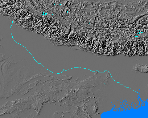
The Ganges River of northern India flows some 1500 miles from its origin in the Gangotri Glacier in the Himalayan foothills of northwest India to its junction with the Brahmaputra River in what is now Bangladesh. The river is sacred to Hindus, but it was already badly polluted in 1941 and a source of waterborne plagues such as cholera and hepatitis.
The river was originally navigable as far as Allahabad. However, the irrigation diversion dam at Haridwar, built by the British in 1854, reduced the volume of flow enough that the river began to deteriorate as an inland waterway. By 1941, there was little steamer traffic north of Calcutta. Most of the river traffic was picked up by the extensive railroad network that the British build in the Ganges floodplain.
Had the Japanese
ever invaded India, the Ganges might have been an important defense
line for the British.
The Pacific War Online Encyclopedia © 2007, 2010 by Kent G. Budge. Index