 The Pacific War Online Encyclopedia
|
| Previous: Christison, Sir Alexander Frank Phillip | Table of Contents | Next: Chromium |
There are two Christmas Islands in
the Pacific-Far East
area.
Indian Ocean (105.672E
10.425S). This Christmas Island
is located in the Indian
Ocean south of Java
and is an important phosphate
island (with production of about 210 tons per year.) It was
annexed by Britain in
1888. The Japanese
raided the island in March
1942, capturing the phosphate stores and destroying the
facilities.
During this raid, the American
submarine Seawolf, commanded
by the legendary Freddy Warder, made numerous attacks on the light cruisers
and destroyers
escorting the raiding force, severely damaging the light cruiser Naka.
The Japanese subsequently withdrew,
and the island remained a no man's land for the remainder of the
war.

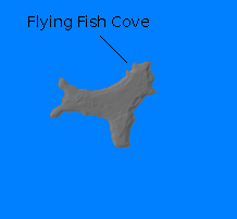
Central Pacific (Kirimati, 157.487W 2.01N). The second Christmas Island is located near the equator south of Hawaii and 380 miles (610 km) southeast of Palmyra. It is one of the geologically oldest atolls known. It is about 32 miles (51 km) long and 17 miles (27 km) wide, with a total land area of 60,000 acres (24,500 hectares). The shallow and foul lagoon open to the west is known as Bay of Wrecks. There are numerous small lakes scattered across the island. The island was populated by just 30 civilians when war broke out, some native and some European. Its only product were copra and pearl shell from the lagoon.
The island was discovered by Captain Cook on December 24, 1777, and annexed by Britain in 1888. Ownership was disputed with the United States in 1936 but neither side pressed the issue. The island had a small airstrip that formed part of the air bridge from the U.S. West Coast to Australia and the Philippines. The island received a small New Zealand garrison against German raiders in 1939 and the garrison had increased to 105 troops and a 6" coastal defense gun by the time war broke out in the Pacific.
The island was garrisoned by about 2000 U.S. Army troops and 12 Pursuit Squadron on 10 Febuary 1942 to help secure the sea lines of communications to Australia.
The island became a base for joint U.S.-British thermonuclear testing in the
postwar era.
Climate Information (Pacific):
Temperatures: Jan 81, Apr 82, Jul 82, Oct 83
Rainfall: Jan 13/10.8, Apr 15/10.5, Jul 14/8.2, Oct 8/3.6 == 99" per annum
References
"Christmas Island
Bomb Tests" (accessed 2010-7-15)
The Pacific War Online Encyclopedia © 2007-2008, 2010 by Kent G. Budge. Index