The Pacific War Online Encyclopedia
|
| Previous: Secunderabad | Table of Contents | Next: Seki Genroku |
|
|
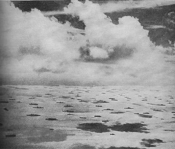 U.S. Navy. Via Morison (1958) |
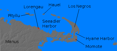
Seeadler Harbor (147.37E 2.036S) is the principal harbor of the Admiralty Islands. A superb natural anchorage, 15 miles long by 4 miles wide (24 km by 6km) and 120' (37 meters) deep, it was almost entirely undeveloped in 1941.
The harbor was secured by the Allies in February-March 1944 (Operation BREWER) and became a major forward base.
References
The Pacific War Online Encyclopedia © 2007, 2009-2010 by Kent G. Budge. Index